A collaboration between National Highways, their technical partner AmW (AECOM, Mace and WSP), and the human experience design company MXT, led to the production of an immersive Virtual Reality (VR) experience. This VR experience was designed with two core principles:The result was a 36 km2 interactive environment synthesising a terabyte of raw information to produce a digital mirror of Stonehenge and its surroundings accessible in virtual reality, desktop and shared immersive spaces.
- Freedom: Users should be able to explore the entire World Heritage Site, getting a before-and-after view of the infrastructural changes.
- Accuracy: Every aspect of the virtual environment had to be supported by real-world data
Examples

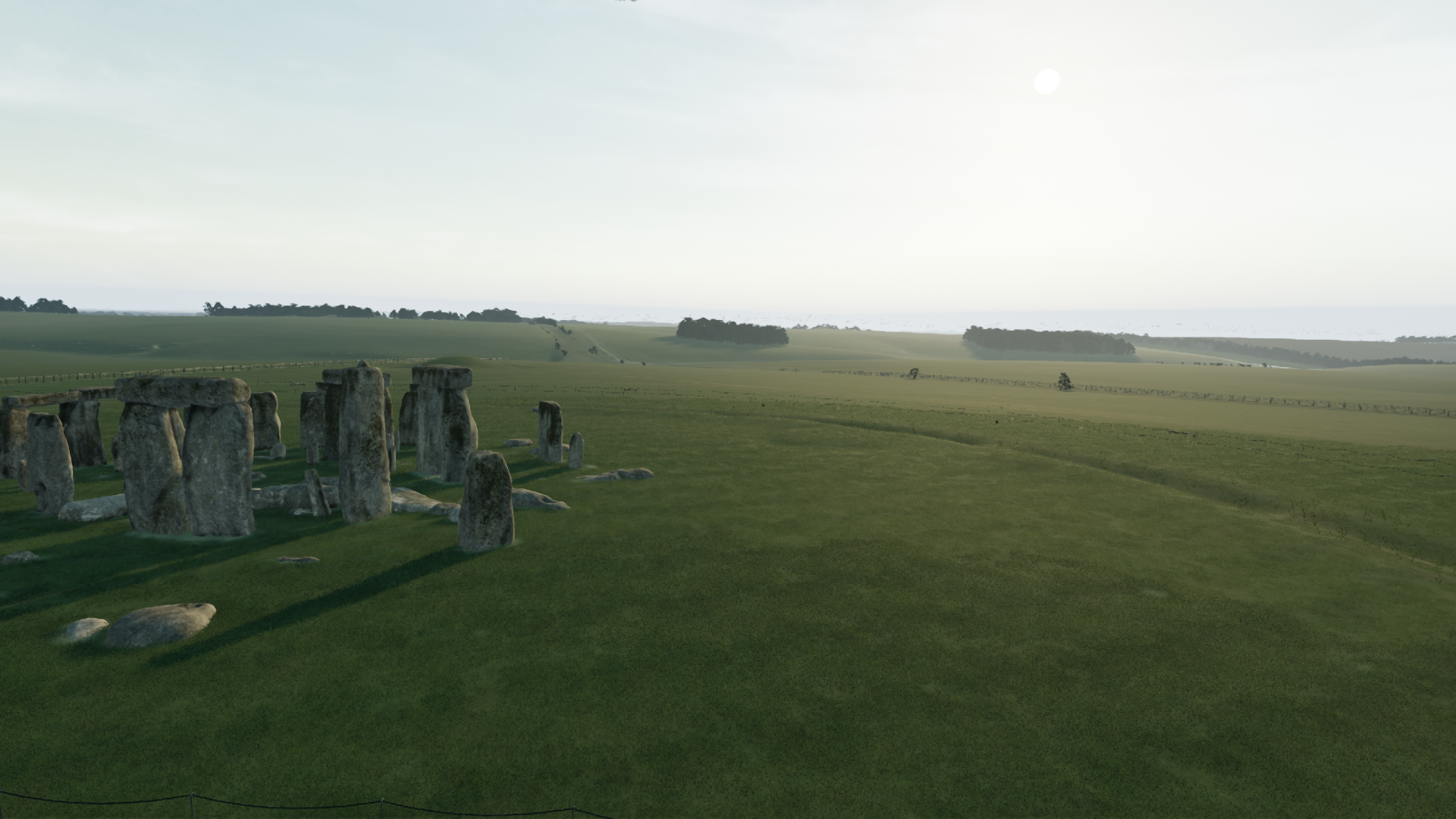
Stonehenge in the unreal editor.
|

A spline based path tool interacting with
the virtual texturing system.
|

A wooded area loaded from National Tree Map
data (position and height)
|
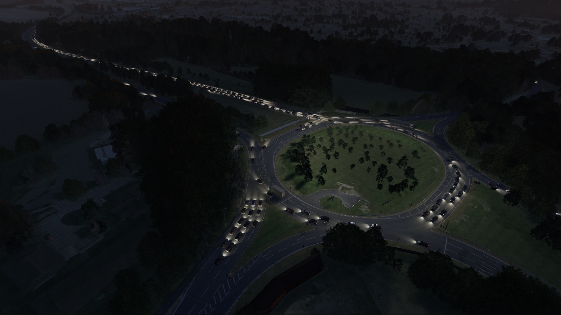
Offline simulated traffic data running through the countess junction at night.
|

Flyover of the countess junction showing
the fusion of CAD (flyover & earthworks) and enviromental data (trees, landscape, grass)
|

The traffic tool in use, splines are used to roughly
align 2D vehicle data with the 3D scene.
|
Further Details

- Material masking.
- Landscape decal importing.
- Instantiating point/polygon data from shape files.
- Non-destructive landscape editing using meshes and splines as input.
- Spline based paths and roads.
Material Masking
We used a varied amount of publicly available datasets including land use;
land type, habitat data, protected areas, woodland maps, road data, path data,
river paths etc... These were used as masks for landscape materials so that we
did not need to paint the entire area by hand.
Each data-set was
seperated into different layers and imported as polygon data. This data was
then drawn into landscape masks with artist-defined blending and ordering.

The appearance of the landscape was further improved by using image decals
from geo-referenced satelite data. We used Unreal engines virtual texture
streaming system for these decals because they were large images and
theoretically only the area near the player needed full resolution.

Shape files
- The National Tree Map - A point based data set that contains every tree in the UK over 3 metres in height.
- Woodland area datasets - These areas were filled with a uniform, random distribution of points for trees and shrubs smaller than 3 metres in size.

Landscape editing tools

- Mesh based landscape manipulation.
- Edits must seamlessly cross landscape boundaries (We had large areas that exceeded the bounds of single landscape actors).
- Edits must be non-destructive.
- Edits must be editable.
- Edits must stack correctly and artists must be able to control the ordering.
Because of these constraints I built a custom solution for editing landscapes in the editor. The final result was the tool below that could cut into or raise the ground with splines. I ensured these edits had a configurable fallof where the artists could modify angle, blending and ordering
Meshes were supported as well and had the same options for falloff.


Path tools
 The
path tool was built to interact with the virtual texturing system. This
meant we could draw directly onto the terrain and occlude grass along
the path.
The
path tool was built to interact with the virtual texturing system. This
meant we could draw directly onto the terrain and occlude grass along
the path.  The
path tool was spline based. These splines could be artist built or
instantiated from polyline data. Paths were resampled in the editor to
ensure they smoothly followed the terrain.
The
path tool was spline based. These splines could be artist built or
instantiated from polyline data. Paths were resampled in the editor to
ensure they smoothly followed the terrain.
Performance profiling
